

The Ruins
Like a lady wooed by her man, the Ruins play with your emotions especially at sunset with its orange pinks and purples hues. He charms, tickles and romances you. But at sundown, the Ruins take a different persona. With blue and golden sights emanating from nooks and crannies, it is now a lady, teasing, flirting, a temptress confident of her beauty as well as her majesty.

Bacolod …. Fun in the Mountain
Motor to the Hawaiian Philippines Company for some orientation on how the famous muscovado sugar is made. Here, you will have a good understanding of the island’s sugar industry and how it is able to sweeten your day.
Municipality of Cauayan
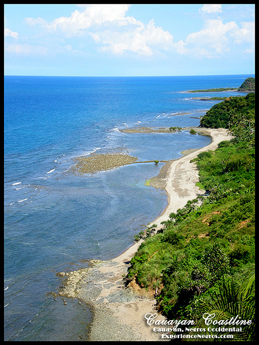
Cauayan is a first class municipality in the province of Negros Occidental,
Philippines. Located on the southern portion of the province, it is bounded on
the east by the Municipality of Ilog; on the south by the Municipality of
Candoni; on the west by the progressive mining City of Sipalay and on the north
by the Panay Gulf with its bountiful fishing grounds.
Tourism
Tourism has recently picked up in the Cauayan Municipality, with its fine white
sand beaches and diverse marine and wildlife.
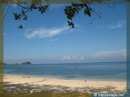
Punta Bulata White Beach Resort, the most developed resort in the area, with an
AA accreditation from the Department of Tourism, has seen tourists from all
parts of the world who come to relax, bask in the tropical atmosphere and enjoy
the marine life that is one of the best in the country.
Danjugan Island Marine Reserve, a wildlife sanctuary in Brgy. Bulata is also one
of the most recognized dive spots in the region. Once featured on the cover of
Mabuhay Magazine, this island has one of the most diverse and highly dense coral
life in the world, comparable to the Great Barrier Reef. Visitors may go for
day-trips to the island with pre-arranged visits by contacting Danjugan Island
or through Punta
Topography
The Municipality of Cauayan has a rugged topography. Mt. Malipantao, considered
the highest peak in the province separates the municipality from the town of
Candoni and the City of Sipalay. Portion of the ranges are the remaining thick
forest that needs protection where the watershed is located. The remaining
portions of the municipality are slightly rolling to moderate large areas of
flat lands center on the different barrios, which is much suited to agriculture.
The municipality consists mainly of the following slope distribution: From
gently sloping at 0-3 percent or equivalent to 5,369.42 hectares to moderately
sloping at 3-8 percent or a total of 1,059.40 hectares to rolling lands with
slopes ranging from 8-18 percent which covers to about 1,716.94 hectares. Bigger
portion is moderately steep with a slope distribution ranging from 18 to 30
percent having a total area of 19,419.42 hectares. However, large areas are
steep and mountains with a slope 30 - 50 percent which accounts to 21,181.92
hectares and to very steep hills and mountains with a slope of over 50 percent
which covers to about 3,246.90 hectares, Moderately large areas of flat land
center on the different barrios. However, the southern part of the municipality
is hilly. The Poblacion and the 12 barangays along the seashore are
approximately 0 - 3 degrees above sea level.
Famous landmarks
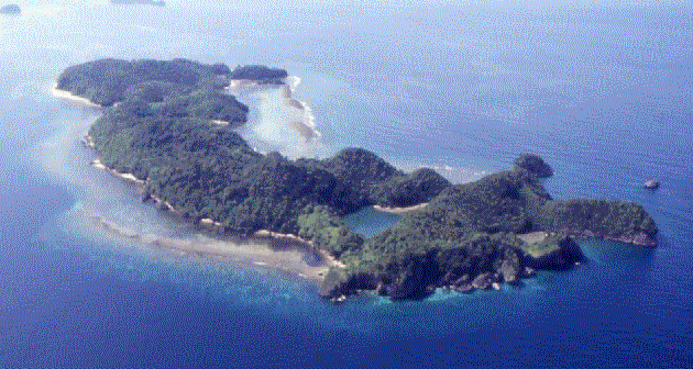
Danjugan Island is the largest of the Bulata Islands in Cauayan whose white
sand beaches and underwater world rich in marine life makes it a favorite
destination of foreign diving enthusiasts and conservationists, particularly
coming from the United Kingdom, among them the Coral Cay Conservation
volunteers.
Managed by the Philippine Reefs and Rainforests Conservation Foundation, Inc,
this 15 kilometers long and half kilometer wide island is comprised of lush
tropical forest, five lagoons, beach and mangrove forests, seagrass beds and
coral reefs.
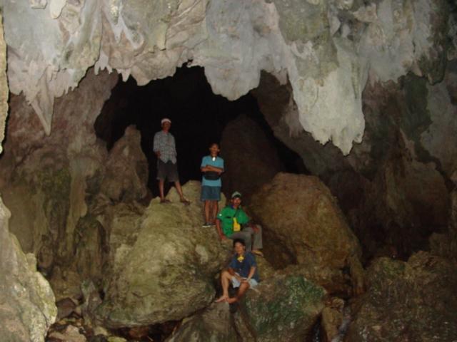
Suha Cave is almost 20 kilometers away from the town proper. Located in Sitio
Suha, Brgy. Camalandaan, the cave has stalagmites and stalactites. It has a
stone in the middle that resembles a giant’s sharp teeth.